 |
| In this June 26, 1977 file photo, demonstrators carry signs of, from left, Adolf Hitler, Anita Bryant, the Ku Klux Klan and Idi Amin, chanting ''Human rights now,'' during the annual Gay Freedom Day March in San Francisco. Bryant, an anti-gay activist, led a successful campaign to overturn a Miami-Dade County ordinance outlawing discrimination against homosexuals in 1977 |
The chilling document, which was compiled in the summer of 1940, contains reconnaissance photographs and maps and every town along the south coast.

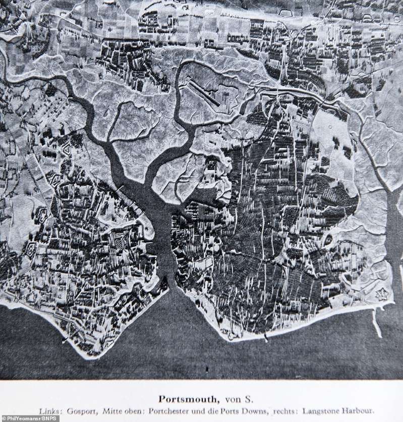 |
| This chilling document, which was compiled in the summer of 1940, contains reconnaissance photographs and maps and every town along the south coast. Pictured is an aerial view of Portsmouth, which was intended to reveal possible landing spots as well as targets for the Luftwaffe to bomb |
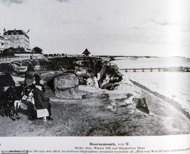 |
| A black and white photograph of Bournemouth which was included in the Nazi invasion plan. The photographs sometimes give the uncanny impression of a vintage travel brochure, with one of the seaside town's famous donkeys appearing in this image. Indeed, the images were likely taken from tourist postcards |
 |
| The pack is titled 'Militargeograogische Angaben uber England' which translates to 'military geographic information about England |
 |
| The bulky dossier is a stark reminder of how well prepared a German invading force would have been had the Luftwaffe not been rebuffed by the RAF in the Battle of Britain. The operation to invade Britain was known as Operation Sea Lion. Pictured is an illustrated map showing Falmouth in Cornwall |
 |
| Palm Bay in Margate, which was a major destination for daytrippers looking to escape the city grime before the outbreak of World War Two |
 |
| The document is incredibly comprehensive and detailed. They even had managed to collect information relating to the Electricity Board as no stone was left unturned in their preparations. Illustrated here is Weymouth in Dorset |
 |
| Women pick daffodils in the fields above the Cornish fishing town of Newlyn. The often idyllic photographs contrast with the chilling nature of the document |
 |
| Corfe Castle in Dorset, an unlikely military target for the Nazis but nonetheless and important landmark that could be used to guide bomber aircraft |
 |
| Old Harry Rocks, three chalk formations, including a stack and a stump, at Handfast Point on the Isle of Purbeck in Dorset |
 |
| The packs were sent to German headquarters' in western Europe in August 1940 in readiness for Operation Sea Lion - the German invasion of Britain. This picture of people using ropes to scale the cliffs at Saltdean near Brighton could have provided the template for a German attack at the same spot |
 |
| Drawings of Beachy Head and Sleaford Head in Dorset, as well as other landscape features including Cuckmere, Willingdon Hill and Birling Gap |
 |
| Ramsgate and its harbour, as depicted in the Nazi invasion plans, which offered views of all the towns on the southern English coast |
 |
| Four years after this document was produced, the Allies issued similar style plans of the Normandy coast ahead of D-Day to prepare their men for the landings. Seen here is a photograph of the sea front at Plymouth |
 |
| Genteel Sidmouth in Devon may seem an unlikely spot for a Nazi invasion, but it was among the many spots depicted in the invasion plan |
 |
| Bournemouth's miles of sandy beaches were also mapped, presumably in case they could be used by landing craft like the Normandy Beaches were during D Day |
 |
| A Luftwaffe aerial photograph of Portland Bill in Dorset, one of the many coastal areas illustrated in the chilling collection |
 |
| A colour map of Weymouth, presumably based on an Ordnance Survey original. Many are marked with circles and numbers drawn by military planners |
 |
| A street map of Southampton, which was a key port and held military installations a Nazi invasion force would have needed to neutralise |
 |
| With air losses increasing, Hitler postponed Sea Lion indefinitely on September 17, 1940 and it was never put into action. Pictured is a geological map included in the collection, which goes up for auction tomorrow |
 |
| Britain's canal network, which was used to move industrial goods around the country. It's inclusion shows the incredible level of detail contained in the plans |


